What Sort of Plan?
Buying Land…….There are several sorts of Plans/ Surveys of your Block to think about before you can start building a house.
Here is a guide to the various plans based on the same block:
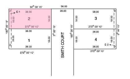
Title Plan
Title Plans are the legal document that describes the land. Initially they are usually the only plan that is available They are limited to:
- Showing the dimensions and bearings of the boundaries.
- Showing the locations of Easement.
The drawing below is a typical title plan
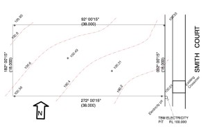
Feature Survey
The Feature Survey is an accurate representation of the block prepared by a surveyor. Typically the information shown is:
- Boundaries.
- Site Contours.
- Locations of trees.
- Any other above ground features such as driveway crossovers and manholes.
If you buy direct from a project builder they will normally arrange the feature survey. If you want to get quotes from several builders it can be worth getting a feature survey done first.
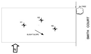
Geo-Technical Plan
The Geo-Technical Plan is more in the form of a sketch than an accurate representation of the site. The main purpose is to indicate the approximate location of boreholes. Other information that may be included is:
- Indication of location of trees as these may affect the Geotechnical Recomendations.
- Any rock outcrops.
- Direction of fall.
- Ponds / swampy areas.
See Blocks for more information on buying land.


